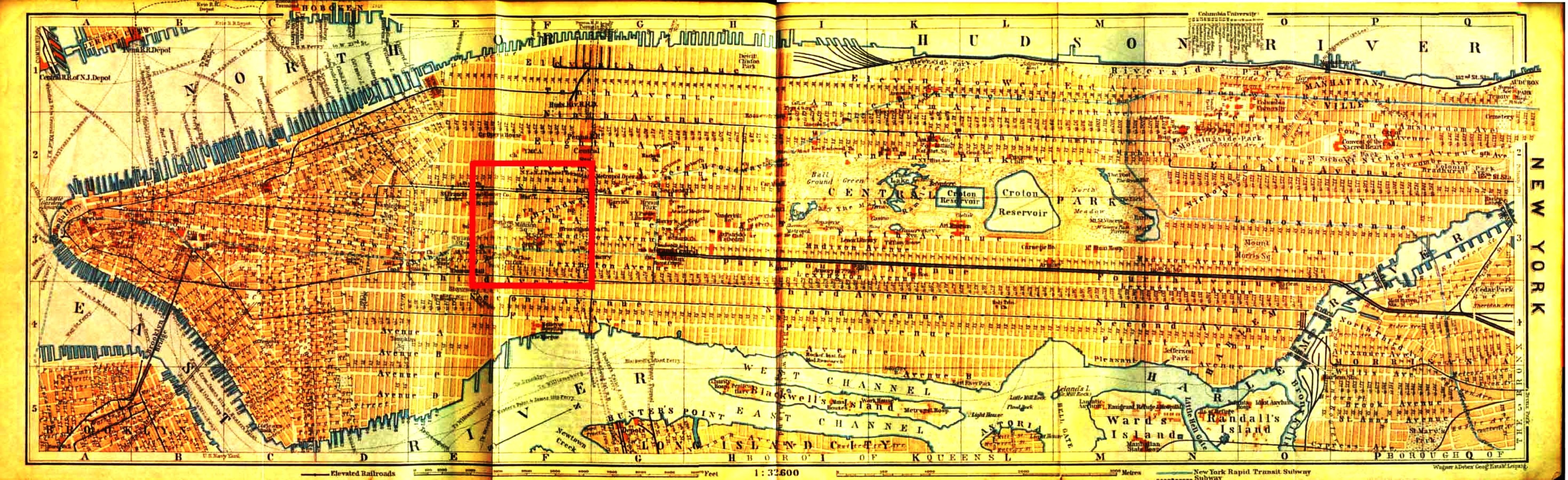
Map
of New York City
(Enlargement)
from
Grove's Own 1909 Baedeker
Guide to the United States
Scroll right
to see the more of Manhattan
Click on the map for a much larger version of New York City
in 1910
For Madison Square area see enlargement of the red
map insert below
|
Source reference:
Baedeker, Karl. The
United States, with Excursions to Mexico, Cuba, Porto Rico, and Alaska : Handbook
for Travellers,
33 Maps and 48 Plans. Fourth Revised Edition. Leipzig: K.
Baedeker, Publisher, 1909.
Double-folded colour map of Manhattan between pp. 10 & 11
The Library of Frederick Philip Grove Collection. University
of Manitoba, Archives & Special Collections
|

 Greve/Grove
Documents
Greve/Grove
Documents